
Warrensburg ZIP Code Directory Coverage
Two postal ZIPs are documented for Warrensburg. They are useful starting points, but they do not define a census of residents or redraw the city boundary. Postal service assigns a ZIP for delivery. County records map parcels, legal descriptions, and districts. A careful Warrensburg ZIP code directory keeps those systems separate, then checks each address through the postal service and the parcel viewer before treating a result as local.
| ZIP | Warrensburg coverage | Post office label | Important limit |
|---|---|---|---|
| 64093 | Standard delivery ZIP for Warrensburg and the surrounding delivery area | Warrensburg, MO | A postal boundary is not identical to city corporate limits. |
| 64096 | Warrensburg PO-box or associated alternate postal routing | Warrensburg, MO | Confirm a street delivery result with USPS before treating it as a residence. |
Official USPS Postal Bulletin material and the Missouri Official Manual list both codes with Warrensburg. The USPS ZIP Code Lookup is the final address-level check. Exact ZIP population and registration totals were not located in the county material, so no code on this page represents a count of people, voters, parcels, or households.
Warrensburg 64093 Postal Records
ZIP 64093 is the standard delivery code associated with Warrensburg city and its surrounding delivery area. A complete address in 64093 may still fall outside incorporated Warrensburg, because a mailing city and a municipal boundary are separate systems. The practical check is three-part: USPS for delivery formatting, Johnson County GIS for parcel and corporate-limit layers, and the Assessor or Recorder for the record type being researched.
Use the county's official postal map to compare countywide postal boundaries and roads with the municipal corporate-limit layer in GIS. The map helps place a location, but it cannot decide whether someone resides at an address. For that question, use the proper record custodian and keep the record's date and scope in the notes.
Warrensburg 64096 Postal Records
ZIP 64096 is documented as a Warrensburg PO-box or associated alternate postal route. It should be treated as a postal-service clue, not a statement that a box identifies a physical location. USPS must return a specific street-delivery result before it can be used as an address-format lead. The local research did not publish the current delivery-type field, so a live USPS check remains necessary for any individual address.
This is a useful postal caution for Warrensburg. A post-office box can share the city name with a property that lies elsewhere, and a parcel inside the city can use a different postal route. Parcel records, voter records, and directories each key information in their own way. They should not be combined into an inferred household roster.
Finding Warrensburg Records by Postal Area
Once the postal code is confirmed, the address can be carried into records that are actually keyed to land or location. This process is about the place, not a promise of a resident list. The GIS and Assessor help distinguish the physical situs from an owner's tax-mailing address. The Recorder uses grantor, grantee, and legal-description paths. Historical material follows older streets and lots rather than a modern postal code.
- Enter the full street address in USPS ZIP Lookup and retain its standardized suffix, city, state, and ZIP+4 output.
- Search the address in Johnson County GIS and note the parcel, corporate-limit status, district layers, and legal-description clues.
- Check Assessor or Collector information by property location or owner, keeping situs and mailing fields separate.
- Use the Recorder's grantor, grantee, or legal-description route for a documented ownership trail.
- For older Warrensburg questions, switch to street, lot, block, directories, Sanborn maps, census material, JCHS files, or newspaper microfilm.
The Missouri voter request form can be scoped by political subdivision, but it does not list ZIP as a requested field. The State Archives census search uses county and year filters, not postal codes. These limits mean postal verification comes first, while public-record searches follow the field each custodian actually maintains.
Warrensburg Parcel Records by Postal Area
Johnson County's GIS viewer is the bridge from a postal address to land geography. Its layers include parcels, address points, 911 roads, owner name or last name, acreage, book and page, subdivision, original lot or block, easements, rights-of-way, corporate limits, districts, flood hazard, and aerial imagery. The county describes mapping and ownership information as reference material, not a legal survey or proof of title. Exact parcel-number syntax was not published in the inspected official text.
| Local tool | Can it settle a ZIP question? | Best use |
|---|---|---|
| USPS ZIP Lookup | Yes, for current delivery formatting | Standardize a complete address and ZIP+4. |
| Johnson County GIS | Not as a documented ZIP filter | Map the address, parcel, city limit, and districts. |
| Assessor or tax route | No standalone ZIP form was located | Check owner, parcel, situs, and mailing data. |
| Voter request | No ZIP field on the documented request form | Use permitted political-subdivision scope. |
The Johnson County GIS parcel viewer displays the local layer menu that makes the ZIP check useful after USPS has normalized the address.
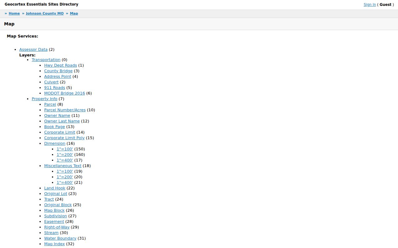
The viewer can connect a Warrensburg street address to a parcel and boundary layers, but the research did not verify a live ZIP filter, buffer tool, or parcel-popup display. Use the visible map as a reference and verify a record field with the Assessor, Recorder, or other named custodian.
Warrensburg Postal and City Record Comparison
Postal geography, municipal geography, and property geography can all use the name Warrensburg while pointing to different things. USPS tells where mail is routed. The GIS corporate-limit layer shows whether a parcel is within the city. A deed's legal description identifies the recorded land. The Assessor's situs is the physical property address, while the mailing or billing address is where tax correspondence goes. None of those fields alone proves the people currently inside a building.
- ZIP versus ZIP+4
- A ZIP identifies a postal area. ZIP+4 adds a more specific delivery segment to the standardized address.
- PO-box ZIP
- A code associated with box or alternate routing rather than proof of a physical delivery address.
- Unique ZIP
- A code assigned to one institution or large recipient. No Warrensburg unique ZIP was identified in the research.
- Carrier route
- A postal delivery grouping that helps route mail but does not set city limits or property ownership.
Warrensburg Records by Postal Scope
Local records are more useful when their scope is named plainly. The postal tool standardizes delivery. GIS supplies map context. Parcel and Recorder records supply land connections. An elections record has its own legal purpose and public-field limits. A historical directory may record a printed street address that predates postal coding. For a narrower address question after a ZIP check, the Warrensburg streets directory uses the parcel and street-record path rather than treating ZIP as a person filter.
| Source | What it can establish | What it cannot establish alone |
|---|---|---|
| USPS | Current delivery format for a complete address | City limits, ownership, or household membership |
| GIS | Parcel map, address point, boundaries, and districts | A legal survey, title, or current occupant |
| Assessor and Recorder | Parcel, owner, mailing, legal-description, or recorded role | Every current person at the address |
| Directories and maps | How an address or building appeared in a historical period | A modern postal code or current delivery format |
Warrensburg Records Before Postal Coding
Modern ZIP codes do not translate backward into older Warrensburg addresses. County formation, Old Town and New Town development, railroad-era growth, and changing plats mean an earlier record may rely on a lot, block, tract, cross street, or adjoining owner. A legal-description and plat check is safer than assuming the current street order matches a directory from 1888 or 1900. The 1958 Cross-Directory is especially useful because it is address-first rather than alphabetical.
For historical address work, compare documented Warrensburg directory runs with Sanborn maps, census enumeration districts, JCHS residence files, newspaper microfilm, and city Document Center material. The Document Center reaches records as early as 1856 and is searchable by keyword and year. That historical search is a different task from a current postal check, but it supplies the right replacement when postal data does not exist for the period under review.
Warrensburg Postal Record Checks and Gaps
No official local source located a named Warrensburg ZIP split, realignment year, or complete street-renumbering timeline. The city zoning and annexation forms can document a boundary change, and GIS corporate-limit layers can place a parcel now, but neither redefines postal geography. Do not assign a historical parcel to a ZIP simply because the city name appears in both records. Ask USPS for delivery format and use City Community Development or county mapping for a current boundary question.
Keep the address version with the source date. A USPS result describes delivery now. A parcel map describes the land as mapped now. A directory or Sanborn sheet describes an earlier address system. A Warrensburg postal reference is most reliable when it reports that difference, identifies the official check, and leaves a missing fact marked as unverified rather than inventing a boundary date or resident count.