
Warrensburg Neighbors, Source by Source
Public records can describe a Warrensburg block without creating a complete household list. Start with parcels and address points to establish which properties touch or face the target block. A voter-list request is the official route for specified registration fields, subject to Missouri restrictions. Historic sources provide an older address layer, and community organizations can supply public contacts. The result needs a date because ownership, registration, and listed addresses can change independently.
| Source | What It Shows About a Block | Access |
|---|---|---|
| Johnson County GIS parcel layer | Adjacent polygons, parcel identifiers, streets, lot or block clues, and owners where displayed | Guest map; reference-only |
| GIS district layers | Corporate limits plus school, fire, water, ambulance, township, and commissioner geography | Toggle layers in the viewer |
| Zoning or rezoning material | Notice-area owner names, proposed use, legal description, and 300-foot notice context | City Community Development or Document Center |
| Voter-registration list | Requested registered names, addresses, precinct, district, and voter-history fields | Johnson County Elections request; noncommercial use only |
| 1958 Cross-Directory | Historic occupants by address | Johnson County Library or JCHS research route |
| Community sources | Public association streets, board contacts, Chamber member businesses, and civic contacts | Public organization pages; not household rosters |
A parcel owner, voter registrant, historic directory listing, and Chamber member each describe a different relationship. The County GIS and Assessor both warn that mapping and ownership information are reference tools. Treat an owner mailing address as tax correspondence, not automatic evidence that the person lives at the Warrensburg parcel.
Warrensburg Neighbors, Parcel by Parcel
The official Johnson County IntegrityGIS viewer is the starting point for the immediate block. Its visible layers include parcels, Address Point and 911 Roads, owner name and owner last name, parcel number and acres, book and page, original lot and block, subdivision, corporate limits, district overlays, flood hazard, and aerial photos from 2015, 2020, and 2025. The rendered service did not document a formal measure or buffer tool, so a map user should identify actual adjoining parcels rather than claim a radius result.
The Johnson County GIS parcel viewer displays the layers that connect a Warrensburg address to its surrounding block.
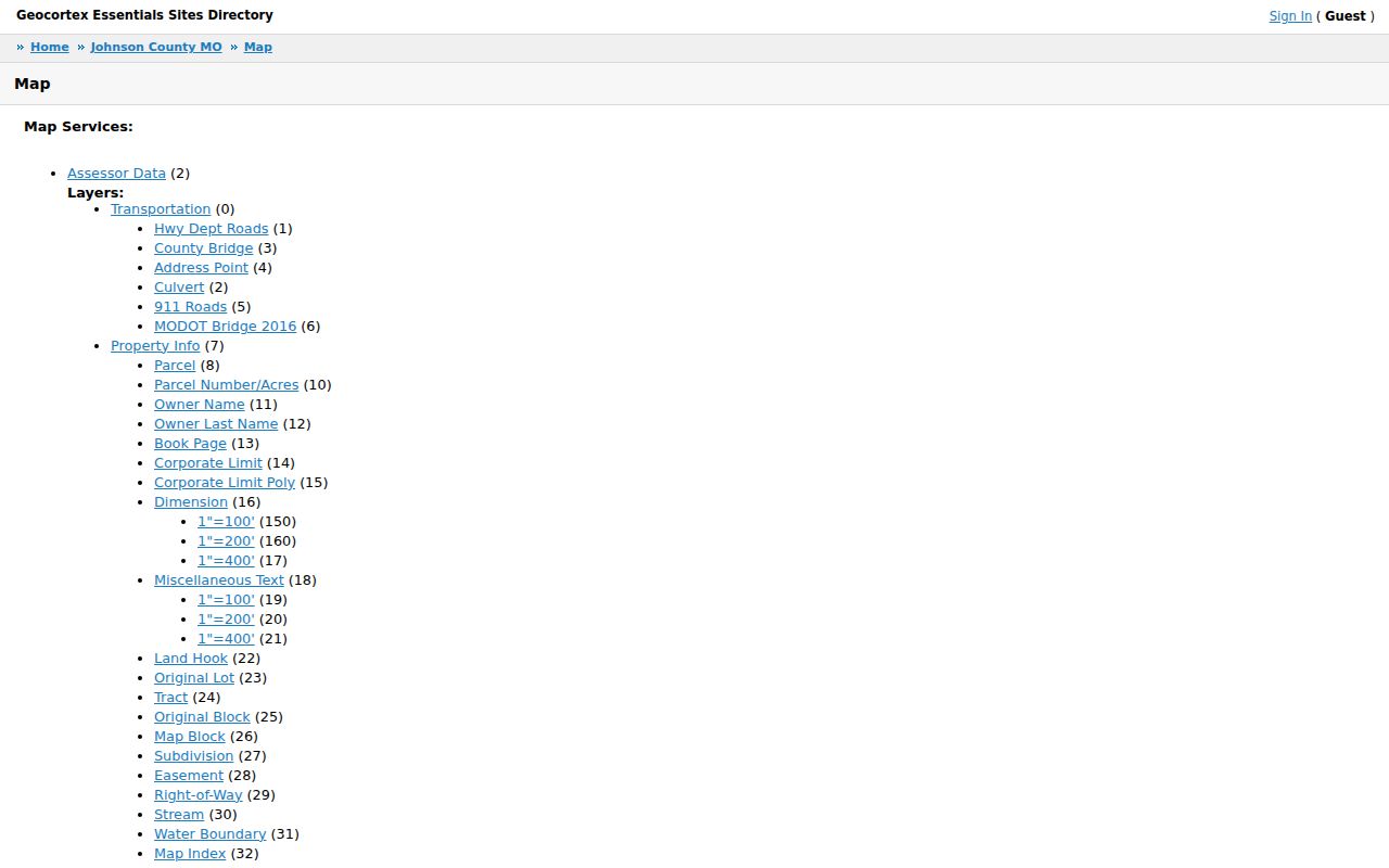
Use a clicked parcel to capture the parcel number, owner label, book or page clue, lot or block, subdivision, and corporate-limit context. Verify a disputed boundary through the recorded plat or deed, not the map line.
- Locate the target Warrensburg address through the address point or 911 Roads layer, then turn on Parcel, Owner Name or Owner Last Name, Parcel Number or Acres, and Corporate Limit layers.
- Click the target parcel and write down the visible parcel and legal-description clues. Then click each parcel sharing a boundary or fronting the same side of the block.
- Use pan, zoom, and identify to continue along the block face. Add district or aerial layers only when they answer a geography question.
- Confirm the displayed owner and legal description through the Assessor or Recorder before treating a map label as current ownership.
- For a full named-street record chain rather than the immediate block, use the Warrensburg Streets lookup.
Property mapping identifies land, not every neighbor living nearby. Renters, household members, delivery records, and utility accounts are not part of this lawful parcel workflow.
Warrensburg Neighbor Voter Requests
Missouri's individual voter-registration lookup is not a block browse. It requires the exact first name, last name, date of birth, last four Social Security digits, and county. A public county voter list is a separate request process. Johnson County states that the public fields include name, address, year of birth, political-party affiliation, and elections voted. Ballot choices are not shown. A requester can ask for a specified political subdivision or countywide scope, but the request is not a casual download.
The Johnson County voter-registration-list request form shows the data choices, delivery options, payment acknowledgement, and required noncommercial-use statement.
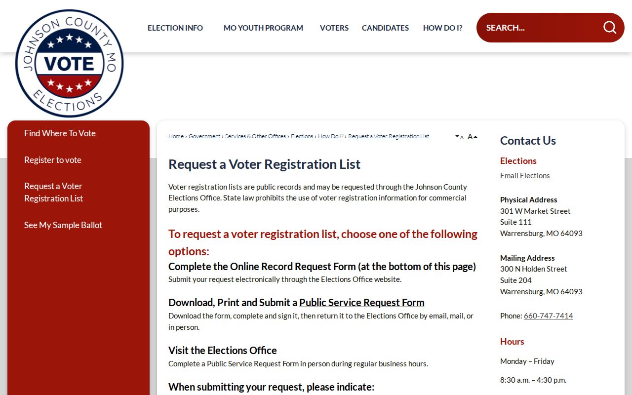
The form allows a request to specify voter ID, name, date of birth, residential address, township, ward, precinct, legislative districts, congressional district, and voter history for specified elections. Voter history means participation, not how someone voted.
| Request detail | Johnson County route |
|---|---|
| How to submit | Use the online form, a downloaded or printed Public Service Request Form, or an in-person form. |
| Delivery choices | Email, USB drive, or printed labels are listed, subject to staff confirmation and payment. |
| Published cost | $15 per voter-registration list and $0.03 per printed mailing label; payment is due before release. |
| Limit | RSMo 115.158.6 bars commercial use of voter lists; a request includes an acknowledgement and purpose statement. |
Johnson County Elections lists an online, mail, and in-person channel at 301 W. Market Street, Suite 111, with mail directed to 300 N. Holden, Suite 204, and phone 660-747-7414. Ask for closed-record segregation when needed. Protected Safe at Home participants use their designated address on new voter records.
Note: Voter history records participation in specified elections, never a ballot choice or a complete list of everyone at an address.
Warrensburg Neighbor Contacts, Not Rosters
Community pages add a different Warrensburg neighbor layer: public ways to reach an association or learn about civic activity. They do not establish who lives in every house. Country View Addition Homeowners' Association publicly lists Fawn Lane, Bear Creek Circle, Nottingham Drive, South Country View Lane, and Country Ridge Drive. Its site provides board contacts, a PO Box, email, and phone, but no member or household directory. That boundary matters when comparing an association's published street coverage with a parcel map.
The Warrensburg Chamber member directory provides category navigation and public business or civic contact paths.
A Chamber listing is voluntary community and business information, not an official neighborhood directory or a certification that someone lives at a given address.
Country View Addition HOA
Country View Association publishes the listed streets and board contact route. Phone: 660-851-4087. Email: CVAHOA@gmail.com. Its member procedure was not published in the reviewed material.
Warrensburg Chamber
The Chamber lists public member categories and community contacts. Its office is at 100 S. Holden, phone 660-747-3168, email chamber@warrensburg.org.
For civic participation tied to an address or project, use City boards, agendas, minutes, and preservation material. The City Document Center can be searched by keyword and year, but an appearance in a public meeting record is not a household roster.
Warrensburg Neighbors, Official or Commercial
Official records and commercial neighbor tools are not interchangeable. The former identify the custodian, field scope, and date, even where the record is limited. Commercial tools are paid data-broker products that can combine parcel extracts, marketing information, and older address data. They can confuse owner and occupant, miss protected residents, or attach the wrong person to an adjacent parcel. For a Warrensburg block question, the relevant official source is more useful than a broad profile assembled from unknown dates.
| Official local record | Commercial neighbor tool category |
|---|---|
| Shows a defined parcel, voter-request field, civic contact, or historic directory entry with a named custodian and access route. | May combine mixed sources with uneven dates and may not identify the underlying record or its limits. |
| Requires the user to distinguish owner, registrant, address listing, and public contact. | Can blur those different roles into an inferred household profile. |
| Allows a source citation, record date, and correction question to be directed to the responsible office. | Can repeat stale or mistaken matching information without proving current residence. |
For zoning or planning notices, use the City record as a notice-area source and heed the City's GIS accuracy warning. A 300-foot notice context can identify owners who were notified about a proposal; it is not evidence that they are all current Warrensburg neighbors.
Warrensburg Neighbor Lookup Privacy
A neighbor lookup has firm limits. Safe at Home participants may use a Secretary of State designated address in new government and court records. Court material can also be sealed or restricted, and vital records, motor-vehicle data, utilities, delivery records, and private association memberships are not a general public block list. If an address and another record conflict, do not try to work backward to a protected location. Ask the custodian which field is public and what date it represents.
The Johnson County Sheriff's public site is an entry point for the inmate roster and for incident, arrest, activity-log, and incarceration-letter record requests.
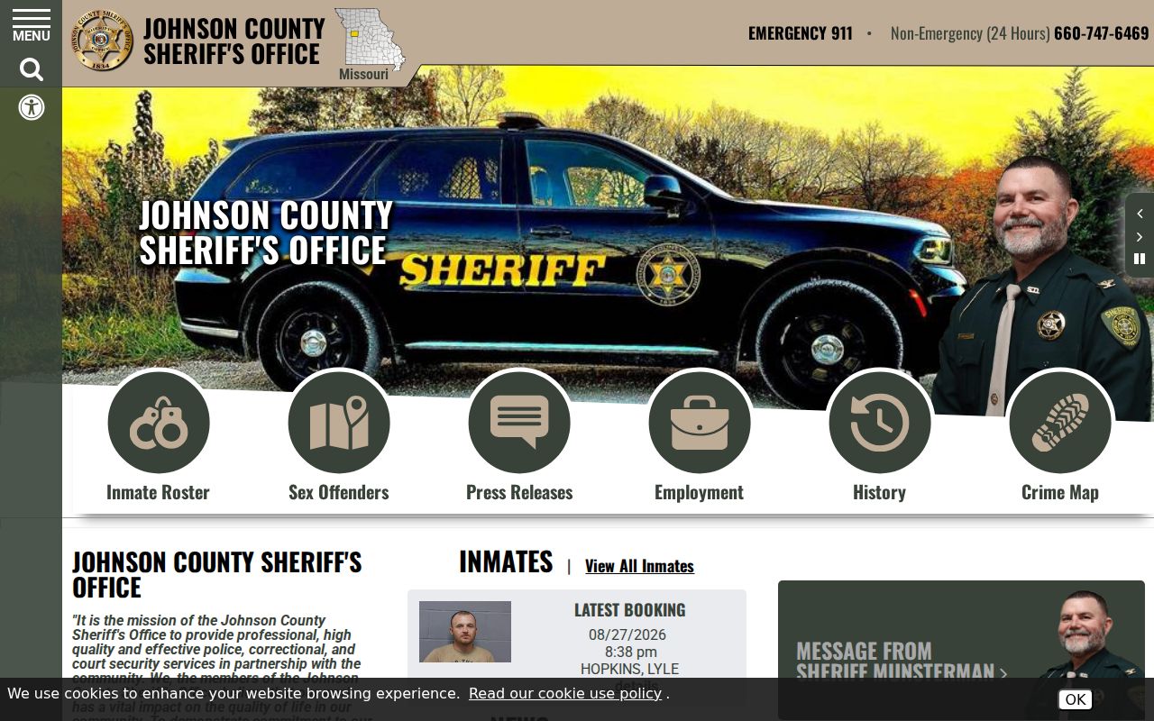
A live roster or law-enforcement request is not a block directory and should not be used to infer a neighbor's residence or conduct. Roster status can change, and incident records may be closed or redacted. For a safety concern, contact the appropriate official agency rather than assembling information about a private household.
The Missouri Safe at Home program explains the designated-address protection. The Missouri Sunshine Law requires a custodian to act as soon as possible and no later than the end of the third business day on an open-record request, subject to reasonable delay and statutory exemptions.
Lawful use. Warrensburg neighbor research is for personal curiosity, civic context, and getting to know a block through public information. Do not use any record to watch, threaten, or harm another person.
Note: Record access does not permit tracking, harassment, intimidation, or attempts to expose a confidential address.
Warrensburg Neighbors in Planning Notices
Warrensburg zoning and rezoning material can add a narrow public block layer. City forms refer to owners within 300 feet for notice purposes and may contain a legal description, proposed use, and named owner information. That makes a planning file useful for understanding who received notice about a nearby proposal. The City also cautions that GIS-derived notice information has accuracy limits, so the notice should be checked against the Assessor, recorded plat, and Recorder before treating it as a current land fact.
The City Document Center and Community Development are the appropriate follow-up routes for an address and time-range request. A permit, rezoning form, or board packet can establish an official planning event. It does not identify every person living on the block or give permission to turn public notice names into private contact information.
Warrensburg Neighbor Block Geography
A block has several overlapping geographies. The GIS viewer can show corporate limits, school, fire, water, political township, commissioner, and ambulance districts alongside parcel and road layers. These controls answer which government or service area reaches a parcel, not who occupies it. They are helpful when a street crosses a city boundary or when a record carries a Warrensburg mailing label while the land lies outside the incorporated area.
Keep the map question narrow. Use the parcel and address-point layers to locate land, the official deed or plat for title and boundaries, and a dated directory or permitted voter request only for its documented record role. That separation prevents a district overlay, mailing address, or owner label from becoming an unsupported claim about Warrensburg neighbors.
Warrensburg Neighbors Before GIS
Before modern parcel layers, Sanborn maps and the 1958 Cross-Directory provide the best documented block context. Warrensburg Sanborn years include 1883, 1888, 1893, 1898, 1907, 1914, and 1945. The maps show building footprints, uses, street and block patterns, not household lists. The 1958 Cross-Directory is the local address-first quirk that can connect a known mid-century address to a listed occupant. Verify the result against the volume, page, and another dated source.
For an older block, the Library of Congress map item, Johnson County Library Genealogy Desk, and Historical Society are more reliable routes than trying to force a current GIS label onto a historic street pattern.