
Walk a Warrensburg Street by Address
Begin with the physical address, not a name. Johnson County keeps Warrensburg parcel and road layers in its GIS viewer, while the Assessor maintains property information and updates ownership after recorded documents. The map is a useful way to move parcel by parcel along a block, including segments that cross a corporate-limit line. It is not a survey or proof of title. For each Warrensburg address, separate the situs address, which is the property location, from a tax mailing address and the recorded legal description. Those three clues can point in different directions.
- Enter the address in the Johnson County GIS viewer. Turn on Address Point or 911 Roads, then parcel and relevant district layers. Record the parcel number, lot or block clue, subdivision, book/page label, and the date of any aerial layer consulted.
- Check the property bridge with the Johnson County Assessor. The office can confirm public property information when a field is not visible in the map. Treat the displayed owner and any mailing address as ownership or correspondence information, not a current occupant list.
- Use the parcel's legal-description and owner clues in the Recorder's iCounty search. Look for the purchase deed, its grantor and grantee, recording date, instrument reference, and any prior instrument cited in the image.
- For a permitted registration question, use the Missouri exact-data lookup for one registered voter, or request a properly scoped Johnson County voter list. A list request can cover a political subdivision and can include residential-address fields, but it is not a casual street-browse download.
- When the question is historical, ask the Johnson County Library Genealogy Desk or the Historical Society for the 1958 Cross-Directory and other documented local volumes. Compare the address, spelling, and year before calling an older entry a past household.
That order keeps the Warrensburg street directory grounded in records that use different keys. Address points lead to parcels, parcels lead to a legal description, and recorded instruments explain ownership changes. A voter registration or a directory listing may place a named person at a date, but neither replaces the other.
Note: Save the parcel number and exact street spelling before switching systems, because historic lot and block descriptions often outlast modern address formatting.
Warrensburg GIS Street Layers
The Johnson County GIS map service is Warrensburg's address-normalization tool. Its visible layers include parcels, address points, 911 roads, owner-name and owner-last-name labels, parcel number/acres, book/page, original lot and block, subdivision, easement, right-of-way, corporate limits, special districts, flood hazard, and aerial photography from 2015, 2020, and 2025. A click and pan approach works better than guessing a number range, especially where a road meets an irregular parcel or the city edge.
The screenshot below comes from the Johnson County GIS parcel viewer. It shows the layer-based setting used to connect a Warrensburg street address with a parcel, but the map's lines and labels remain reference information rather than legal boundary evidence.
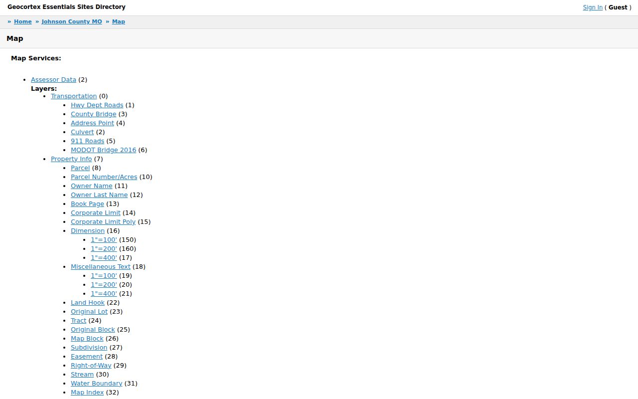
Use a mapped book/page, lot, tract, or subdivision as a lead for the Recorder or Assessor. Do not treat a map label as the controlling document. The recorded deed, plat, or survey is the source for a legal land conclusion.
| Warrensburg GIS item | Form | Street research use |
|---|---|---|
| Address Point and 911 Roads | Map layers | Standardize the situs address before checking a parcel. |
| Parcel and Parcel Number/Acres | Click feature and label | Connect a street location to an identifier and adjoining polygons. |
| Owner Name and Book Page | Labels or attributes | Generate a cautious lead for Assessor and Recorder follow-up. |
| Lot, Block, Tract, and Subdivision | Map attributes | Bridge modern mapping to plats and historic blocks. |
| Corporate limits and district layers | Toggle layers | Distinguish municipal context from county or special-district geography. |
Warrensburg Assessor Street Records
The Assessor's public service is a vital part of a by-address Warrensburg search, even though the official assessor page does not expose a separate text-search form with a published field list. The office assesses property, maintains parcel maps, records ownership updates after instruments are recorded, and updates improvements, splits, and combinations. For an unexposed detail, call the office or visit the South Annex at 1310 S. Maguire Street, Suite B. Its listed phone is 660-747-9822 and listed hours are Monday through Friday, 8:30 a.m. to 4:30 p.m.
The Johnson County Assessor page is the official access point shown here. It confirms that property ownership and mapping are public reference services, while warning that they are not legal surveys or proof of ownership.
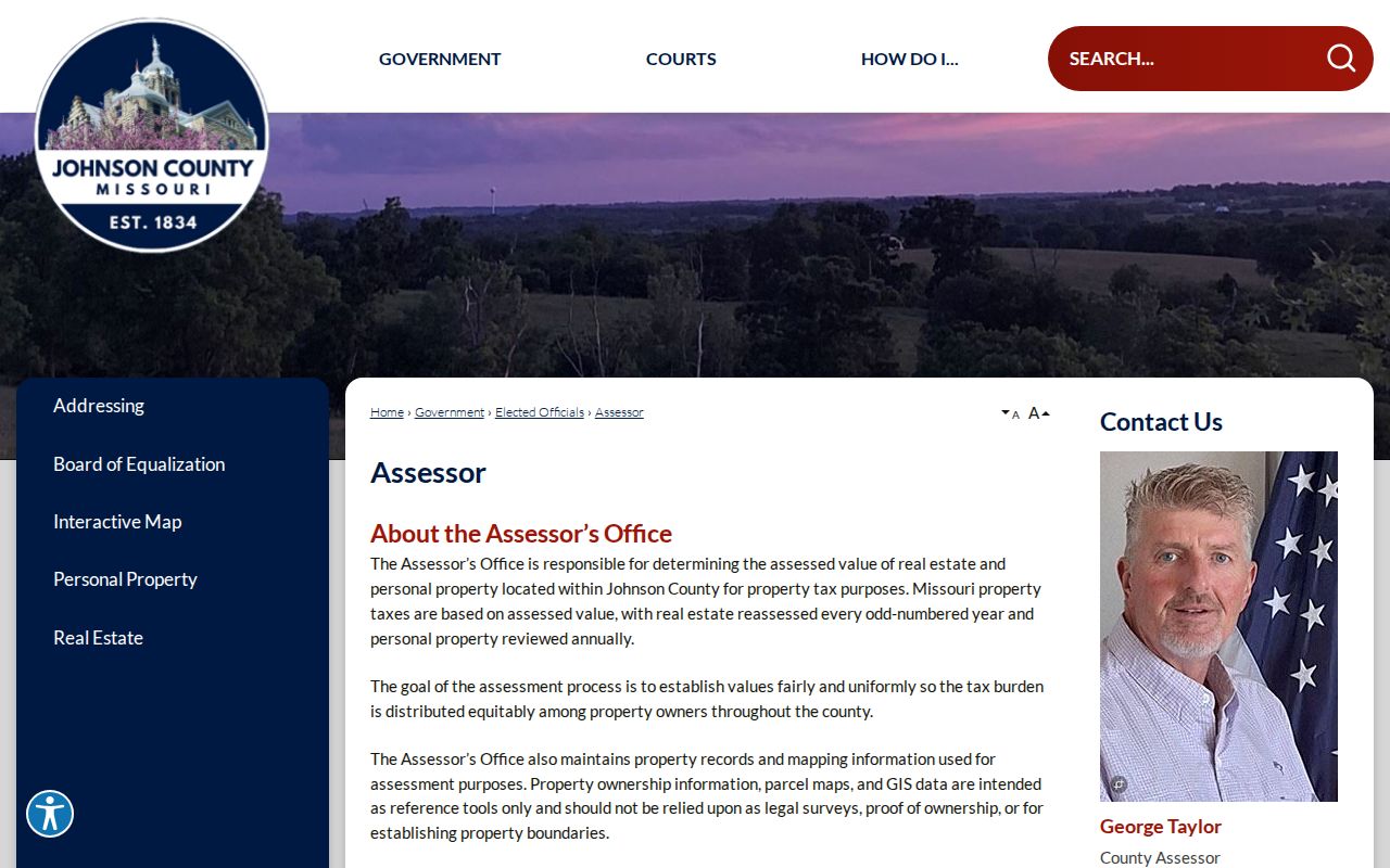
For a Warrensburg street directory search, the practical result is a parcel bridge, not a claim that the site offers every property field online. Ask the Assessor to verify a public property or owner detail that is missing from the GIS display.
| Assessor or GIS field | Type | Availability and use |
|---|---|---|
| Address or situs | Text or map click | Use the address point and parcel layers; a standalone format is not published. |
| Parcel number | Label or attribute | A stable parcel clue when visible; the official local syntax is not published. |
| Owner name or last name | GIS layer or label | May be displayed by the viewer; verify with the office before relying on it. |
| Book/page | Label or attribute | Recorded-reference clue for a Recorder search. |
| Lot, block, tract, or subdivision | Map attribute | Useful legal-description bridge for plats and deeds. |
| Mailing address, value, exemption, sketch, or year built | Parcel fields | Not exposed in the inspected public map view; ask the Assessor rather than inferring. |
- Parcel
- A mapped unit of land used by the county for assessment. Its polygon is helpful, but it is not a legal survey.
- Situs address
- The physical location of the property. It is different from the owner's tax mailing address.
- Plat
- A recorded map that lays out lots, blocks, streets, easements, or subdivisions. It can clarify a map clue.
- Criss-cross directory
- An address-first directory section that can connect an older street address to a printed name.
Warrensburg Deeds Behind an Address
Street numbers are not legal descriptions. Johnson County's Recorder of Deeds holds recorded land documents and Johnson County marriage licenses. For a Warrensburg property trail, the parcel number, legal description, owner name, book/page, and recording date are stronger keys than the street address alone. The Recorder's document families include warranty, quitclaim, beneficiary, transfer-on-death, correction, executor's, and personal representative's deeds; liens, releases, easements, rights-of-way, plats, surveys, and affidavits of heirship can also explain a change in the record.
The iCounty Recorder search presents a registered-user route as well as paid image and printing options. The screenshot documents its access panel. It does not demonstrate a public parcel or street-address search field, so use a party name and legal-description clue rather than assuming that filter exists.
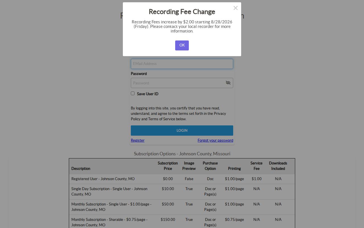
A registered user can search without the paid subscription level, while previewing or printing images depends on the selected option. Listed iCounty options include free registered access with no image preview and $1-per-page printing plus a $1 service fee; single-day and monthly choices allow different preview or per-page terms. If online access ends or an image is gated, use the Recorder counter, the county's written record request route, or the Johnson County Historical Society's original deed holdings from 1834.
Recorder staff list 660-747-6811 and a regular courthouse address at 300 N. Holden, Suite 305, while county offices have been using temporary quarters at 301 W. Market during the renovation. Call before visiting. The county also directs users to iCounty support at 816-295-1540 for online access. A county record request can route a land document request when the counter or online index is not enough.
Note: The official pages do not publish an online-index start year, so confirm coverage with the Recorder before treating a blank iCounty search as a missing deed.
Warrensburg Deed Watch Alerts
Johnson County's free Deed Watch service gives a Warrensburg researcher a way to monitor a name for newly recorded documents. A registered iCounty user defines the name to watch and receives notice when a matching instrument is recorded. It can be useful after an address trail identifies an owner, an estate representative, or another party whose recorded activity needs attention. The service does not determine whether a document affects a particular parcel, whether the party is the same person, or whether the instrument changes ownership.
Read the recorded image, legal description, recording date, and grantor/grantee information before adding an alert to a by-address record trail. When the online image is unavailable under the selected iCounty access level, use the Recorder counter, the county request route, or the Historical Society's original county records. An alert points to a document; it does not replace the document or the recorded chain.
Warrensburg Street Voter Requests
Election data can add a current registration clue, but it is not a street directory in the ordinary sense. The Missouri Secretary of State's Check Your Voter Registration route requires the exact registered first and last names, date of birth, last four digits of the Social Security number, and county. It checks one registration match at a time. A no-match can reflect a spelling or registration-data difference, a move, or a protected record.
For a permitted broader request, Johnson County Elections accepts an online form, a downloaded and printed Public Service Request Form, or an in-person form. A requester can choose countywide or political-subdivision scope, specify fields such as name, residential address, township, ward, precinct, districts, or voter history, and select email, USB drive, or printed labels where available. The listed fee is $15 per voter-registration list and $0.03 per printed mailing label, paid before release. The form asks for purpose, delivery choice, a fee ceiling, and a noncommercial-use acknowledgment.
The Elections office is listed at temporary 301 W. Market Street, Suite 111, with a mailing address at 300 N. Holden, Suite 204, phone 660-747-7414, and Monday through Friday hours of 8:30 a.m. to 4:30 p.m. Missouri law restricts commercial use of voter lists under RSMo 115.158.6. Voter history means participation in specified elections, not ballot choices. Safe at Home participants use a designated address in new records, so a missing physical address may be intentional.
Warrensburg's 1958 Reverse Directory
The useful local quirk is the 1958 Cross-Directory of Warrensburg, published by The Service Company. Most city-directory work begins with a name, but this volume provides an address-to-occupant route. It is therefore a better historical companion to a Warrensburg street directory than a generic alphabetical book. Start with the known address, then check the alphabetical section for the printed name, occupation or business clues, and spelling variants.
The 1958 book is a documented local run, not proof that every resident appeared or that the book covers every year. Johnson County Library's Genealogy Desk has city directories, local yearbooks, maps, microfilm, microfiche, and a 1977-2000 obituary card file. Volunteers are listed Monday through Saturday from 9 a.m. to 4 p.m. and Sunday from 2 p.m. to 4 p.m. The Mary Miller Smiser Heritage Library adds a residence database, business database, old newspapers, plat indexes, family files, tax and probate material, and original county records.
The library route is often the fastest local check. The Historical Society is the deeper fallback for original material or a source citation. For a longer chronology of directory volumes and how to read them, use the Warrensburg city directory collections rather than assuming the 1958 book is a complete annual series.
Warrensburg Street Permits and Plats
City construction and planning files can connect a Warrensburg address to a project, applicant, owner, or stated date. Building applications are electronic and require registration, but the city did not expose a public historic permit-search screen or its filters. Request a permit file from Community Development through the city records process and give the address, approximate date, permit type, and owner or applicant if known. A code-violation report is not proof of a violation or of who occupies a property.
Rezoning, plat, variance, conditional-use, and annexation materials can also supply block-level context. Warrensburg zoning forms may identify owners within 300 feet, but the city warns that GIS and real-estate information used for notice can be inaccurate. The official zoning map is an in-person City Hall fallback, and the map itself is not a survey. For recorded lot, block, easement, or boundary questions, return to the Recorder's plat or survey rather than relying on a planning map.
The City Clerk accepts public-record requests through the Warrensburg Form Center or through City Hall. Missouri Sunshine Law access rules require a records custodian to act as soon as possible and no later than the end of the third business day, subject to a stated reasonable delay. The city form's exact fee and field details were not exposed in the reviewed material, so ask the custodian to confirm them.
Warrensburg Address History and Geography
Warrensburg's address trail crosses more than one record era. Johnson County formed in 1834, Warrensburg became the county seat in the 1830s, and the railroad reached town in 1864. The courthouse moved from Old Town Main Street to New Town Holden Street in 1875, a temporary courthouse burned in 1896, and the historic courthouse opened in 1898. Those changes do not alter jurisdiction, but they do affect where older records are kept and how a street or block is described.
During the current courthouse modernization, many county counters use 301 W. Market, while the Justice Center at 101 W. Market remains the court location. Older land descriptions may use a survey, tract, original lot, block, or adjoining owner rather than a present-day street number. When an old Warrensburg directory or deed does not match a modern map, test the historic suffix, cross street, subdivision, and legal-description clues before declaring a gap.
Corporate limits and postal labels also differ. The GIS corporate-limit layer answers a jurisdiction question, while a postal ZIP directs mail. A deed's legal description is the strongest land identifier. That distinction prevents a Warrensburg street search from turning a mailing city, a map label, or a tax address into an unsupported claim about a household.
Limits of Warrensburg Street Records
Address records have clear boundaries. Assessor and deed records can identify an owner or a transfer, but current household members are not guaranteed in those records. An owner may live elsewhere, and a mailing address may simply be the place for tax correspondence. A voter registration confirms a registration fact, not every person at a home. A court address describes a filing, and a business record describes an affiliation, neither necessarily a present residence.
DMV residence data is restricted under the federal Driver's Privacy Protection Act, and utility customer lists are not public household directories. GIS parcel lines and zoning maps are not surveys. Use a certified plat, legal description, or the Recorder's document when a boundary matters. For an old name or past address, library and archive sources may supply a lead, but they should be cited by volume, page, and repository.
Lawful use. Warrensburg street and address records support personal, lawful research and property curiosity. Do not use names, addresses, or record fragments to stalk, harass, intimidate, or harm another person.